What’s a Redline?
Trusted by:


![]()
![]()

![]()
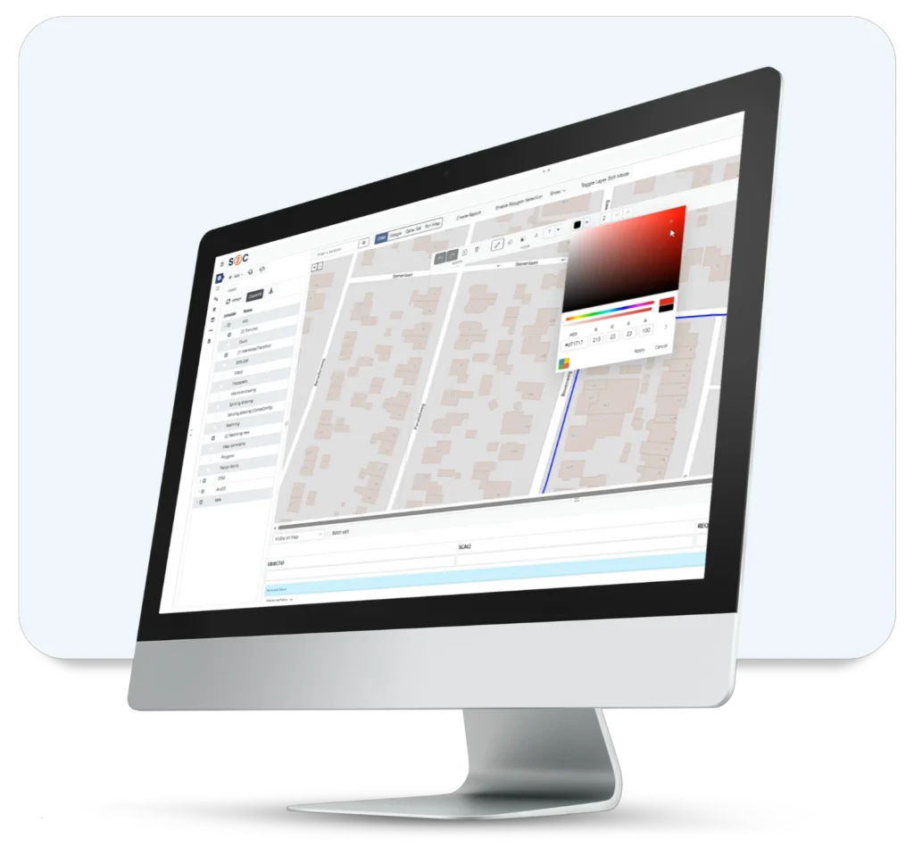
S2C’s Redlining Tool in Action — From Markups to Operational Intelligence
In network infrastructure, one line can make all the difference — especially when it’s drawn with purpose.
Whether you’re coordinating a city-wide FTTH rollout, flagging a duct at risk, or aligning multiple stakeholders on planned maintenance, the ability to visually highlight and share zones of interest is critical. That’s where redlining steps in. But S2C doesn’t just offer redlining. It turns it into a useful operational tool — collaborative, traceable, and integrated with real-time GIS and workflows. Let’s explore what redlining means inside Service2Create (S2C) — And how the redlining tool helps solution architects, planners, NOC teams, and field engineers turn spatial insights into structured operations.
1. Drawn to Action: What Is Redlining in Network Operations?
Redlining, in S2C, is the ability to overlay visual annotations onto live GIS and network maps without changing the core data.
These digital markups can be:
- Circles or polygons around service zones
- Annotations highlighting risk areas
- Visual notes during planned or emergency works
- Field engineer sketches directly from site
But unlike static screenshots or emails, redlines in S2C are:
- Stored in the system (not lost in inboxes)
- Multi-user visible
- Linked to workflows, assets, and orders
In short: redlining isn’t just markup. It’s a visual, collaborative decision-making layer for network operations.
2. Old Way vs. S2C Redlining: The Grid That Says It All
| Feature/Action | Traditional Methods | S2C Redlining |
| Drawing tools | Manual sketches, PDFs | GIS-integrated drawing tools |
| Data linkage | None | Linked to network objects (equipment, services) |
| Collaboration | Email chains, screenshots | Live multi-user map markups |
| Visibility across departments | Low | High (Role-based) |
| Integration with workflows/orders | Not possible | Create planned works from redline |
| Format exports | Basic PDF or image | KML, SHP, DWG, PDF |
| Data safety (non-destructive) | High risk of overwrite | 100% safe overlay (no inventory edits) |
| Usable in field and HQ | Sometimes | Yes (cloud-native, responsive UI) |
This comparison shows clearly: S2C doesn’t just add redlining — it industrializes it.
3. Real-World Ready: Use Cases that Redline the Future
Use Case 1: FTTH Planning
Plan fiber zones by redlining buildings and streets on the GIS layer, attach notes, and convert into a work order directly.
Use Case 2: Emergency Response Mapping
During an outage, field engineers can mark damaged areas and share live with NOC teams. Combined with S2C’s impact analysis, response time is cut dramatically.
Use Case 3: Municipality Coordination
Mark up road construction zones or high-traffic areas and share redlined maps with city authorities — no external tools needed.
Use Case 4: Pre-Design Reviews
Before committing to a rollout, planners can draft areas of interest, overlay network capacity info, and present annotated maps in team reviews.
4. From Drawings to Decisions: How Redlining Feeds the Engine
Redlining is powerful on its own — but in S2C, it doesn’t stop at drawing.
Each redline can be:
- Linked to a specific workflow, triggering actions
- Attached to a planned work reference
- Used to filter affected services and run impact analysis
- Tagged with user names, timestamps, and audit logs
In other words, it’s not just visual — it’s fully operational. And because it’s integrated into the same platform that manages your assets, workflows, inventory, and GIS — there’s no copy/paste, no upload, no syncing needed.
5. Draw Smarter. Work Faster. Collaborate Better.
S2C’s redlining tool isn’t just a feature. It’s a mindset shift — from working in silos to acting as one.
With one intuitive tool, you can:
- Turn visuals into work orders
- Bridge communication across NOC, field, engineering, and city partners
- Annotate GIS and logical maps without breaking inventory
- Accelerate how fast teams understand, decide, and act
In a connected world, clarity wins. And redlining is the simplest, smartest way to deliver it.
Want to see S2C Redlining live?
Get in touch at sales@vc4.com or request a live demo — we’ll draw the line together.